In the unique context of island communities, understanding how tow trucks find vehicles can be vital for auto repair shops, dealerships, property managers, resort operators, and commercial fleet operators. Vehicle towing is a common occurrence, whether due to illegal parking, roadside assistance calls, or crowd-sourced alerts. Each scenario has its own methods for tracking down towed vehicles, relying on technology, official records, or user reports. A comprehensive grasp of these methods not only aids in recovering your vehicle promptly but also enhances collaboration with towing services, ensuring smooth operations in your business.
Tracing the Tow: How Tow Trucks Locate Your Car After a Towing Incident
When a car is towed, most drivers assume the tow truck has some hidden sensor or a magic beacon that points to the exact location of the vehicle. In truth, the process is a carefully choreographed sequence built on official records, precise communication, and real world logistics. The question of how a tow truck finds a car after a towing incident is not answered by a single gadget or feature. It is answered by the collaboration of authorities, property managers, towing operators, and sometimes the vehicle itself through connected systems. What follows is a coherent look at how that collaboration unfolds, why it is designed the way it is, and where a car ends up once it leaves the curb for an impound lot or a private yard.
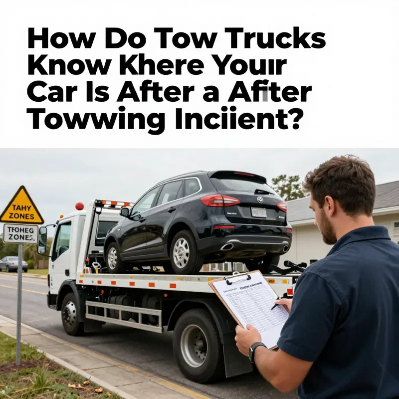
The moment a decision to tow is made, the chain of action begins. In many cities the decision comes from law enforcement after an incident such as a traffic violation, an accident, or a request by a parking authority to remove an abandoned or illegally parked vehicle. In private settings a tow may be initiated by a property manager or a business owner who has authority to enforce parking rules on their lot or street. In all cases, the initiator has knowledge of the vehicle’s existence at a specific location and a reason to move it. This knowledge travels, in a sense, like a digital breadcrumb trail through the system. The information that matters most to the towing operator is precise: the license plate, the exact location, and sometimes a description that confirms they are dispatching to the correct car. The specifics can be as granular as a street address or as plain as a marked parking spot or curbside location inside a lot. The goal is simple and essential: make sure the right car is identified, and the tow is executed cleanly without complications.
Crucially, the tow operator does not rely on an autonomous tracking device that continuously hunts for the vehicle. The driver does not set off on a journey with a beacon that announces the car’s location from miles away. Instead, the dispatch process provides the driver with the precise coordinates or directions to the spot where the car will be found. This is typically accomplished through a dispatch system or phone communication, where the issuing authority relays the details directly to the towing company. The operator then translates those details into concrete travel instructions. The driver navigates to the location much like a taxi driver would go to a known pickup point, using street addresses, lot numbers, or pinpoint coordinates that can be entered into a GPS device or mapping system. In this context, the vehicle’s location is not inferred by the tow truck’s sensors but supplied by a reliable source that has a legitimate interest in towing the car.
The verification phase is simple but essential. On arrival, the driver does not simply lift any car that happens to be at the curb. The process involves a careful cross check. The plate number, sometimes the VIN, and a description of the vehicle are compared to the towing request. If the car’s identity matches the record, the tow proceeds. If there is any doubt, the driver will pause and verify with the person who issued the tow or with the dispatch center. This step, though it may feel tedious, protects against errors in the hectic environment of streets and lots and reduces the risk of taking the wrong vehicle. It also acts as a practical safeguard for owners, who may fear misplacement or misidentification in the chaos that can accompany towing operations.
What happens next depends on the vehicle’s fate at the end of the street. If the car is towed after a violation or because it is parked illegally, the vehicle is typically moved to an impound yard or a designated storage facility. In many places the impound lot is not a single site but a network of facilities that may be coordinated by a private operator, a municipal department, or a contracted agency. Each car that arrives is logged into a centralized system that tracks the vehicle by license plate, VIN, and the time of arrival. The database acts as a digital ledger that can be consulted when the owner calls to locate or retrieve the car. The presence of a vehicle in the system confirms that the tow happened and establishes the exact timing, the location of the tow, and the status of the vehicle in the possession of the impound. For the owner seeking retrieval, this centralized record is the first point of contact and the most reliable source of truth about where the car has been moved to and how long it will remain in custody.
In the event the car is towed as part of an emergency roadside operation or after a collision, the same principle applies, but the path to the vehicle can be more complex. Emergency operations often involve multiple agencies and responders who may coordinate with a towing contractor to ensure that the vehicle is removed and the scene cleared. In such cases the towing company receives a precise location from the responding unit or from a designated staging point and then executes a careful transfer to an impound facility or to a repair shop as directed. The driver must confirm the identity of the vehicle before loading it, and the same verification steps apply to ensure the right car is taken away. The emphasis remains on accuracy and accountability, because mistakes can create significant inconvenience and legal issues for all parties involved.
Private property tows add another layer of specificity. Here the party initiating the tow—often a property manager or a business owner—knows exactly where the car is located and what rule is being enforced. The dispatch details furnished to the tow operator typically include a parking stall number, a marked space, or a clearly defined boundary within a lot. This information is critical because it eliminates guesswork and minimizes the time the driver spends searching the property. The result is a more efficient operation, a shorter window of disruption for other drivers, and a traceable record that can be reviewed later if needed. The vehicle’s stay in the impound system follows the same pattern as in public tow scenarios: log the arrival, assign an identifier, and retain the record so the owner can locate and retrieve the car when appropriate.
A key point often overlooked by casual observers is that the car’s location after a tow is not fed to the towing company by real time sensor data from the vehicle itself. There is no universal standard that allows a tow truck to broadcast a live beacon from the car to the operator. Instead, what the operator relies on is the chain of information created by the issuing authority and the explicit directions given to the towing crew. The vehicle becomes known to the system because it has a documented presence in the location where the tow is supposed to begin, not because it can be discovered by the tow truck’s own instruments. The dispatch information is the compass, and the on site verification is the lock and key that ensures the correct vehicle is in the hands of the operator at every step of the process.
That said, there are scenarios where a location can be discovered or alerted through connected technologies, but these are not the same as a tow truck independently locating a vehicle. If a vehicle is equipped with a telematics system or a connected service that the owner has enabled, a towing provider may be able to obtain a location update during a roadside assistance request or a recovery operation. In those cases the owner has granted permission for data sharing, and the service can provide a precise coordinate or a nearest address to the operator. The advantage is clear: it speeds up recovery when a vehicle is immobilized or stranded. The caveat is privacy and consent. Access to location data is governed by user permissions and policy boundaries, and tow operators must operate within those boundaries to respect the owner’s privacy while delivering efficient service. Even when such data is accessible, it is typically used to support the service being requested rather than as a standing capability that allows continuous tracking of any car at all times.
Crowd sourced alerts present a different facet of the locating puzzle. In some communities and apps, drivers and bystanders report towing activity, find zones where enforcement occurs, or share tips about where to locate a recently towed vehicle. These reports can be helpful to those who are actively seeking a car, especially in busy corridors or at large complexes where many vehicles may be towed in a short period. However, these apps work on user input and are not official channels of record. Their reliability varies, and even well intentioned reports can be outdated or inaccurate in moments when a vehicle moves from one location to another or is relocated after an initial tow. The practical takeaway is that while crowd sourced tips can offer useful context, the agreement between the owner and the formal authorities or the towing operator remains the core source of truth for locating a car after a tow. The goal is to reduce the time a vehicle sits in limbo and to prevent misdelivery, not to rely on a social feed to confirm a car’s whereabouts.
If you’re trying to locate your own towed car, the wisest path is to initiate contact with the party who issued the tow. This means reaching out to the police department or parking authority for information on the tow, or contacting the private towing company that was dispatched. Providing the license plate, the vehicle description, and any reference numbers associated with the tow will usually yield the fastest results. In some jurisdictions there are dedicated towing hotlines or impound offices where you can confirm whether the car has been brought in and where it is being held. The impound staff can look up the vehicle by plate or VIN and tell you how long the car will remain in custody and what fees you can expect when you retrieve it. The process is designed to be efficient and accountable, so that a worried owner can obtain precise directions, determine the next steps, and recover the car with a clear understanding of the charges and timelines involved.
The structural logic of this system has a practical logic that resonates in other parts of the service ecosystem as well. For example, fleet operators, emergency responders, and municipal agencies rely on standardized procedures that ensure every movement of a vehicle is documented. When a tow is authorized, the location and the vehicle details become part of the official record. This record persists through the transport, storage in an impound, and the eventual release to the owner. The integrity of this chain matters because it protects not only the owner but also the public system that regulates traffic, enforces rules, and maintains safety. If a tow goes astray, the consequences ripple outward: delays in recovery, disputes over charges, and concerns about who authorized the removal and why. The disciplined structure of the process is the reason a car can be located reliably despite the absence of a magical tracking device in the car itself.
For readers who want to explore more about the practical mechanics and broader context of fleet coordination and emergency response strategies, there is a rich set of resources that speak to the interface between field operations and centralized administration. The dynamics of how a tow occurs on a busy street, how the dispatch system translates a location into a route, and how the impound network preserves a vehicle’s status all come together in a workflow that is at once technical and human. The human element is central: drivers must interpret directions, verify identity, and communicate clearly with the entities that initiated the tow. The digital scaffolding—the records, the databases, and the dispatch interfaces—provides reliability, but the human checks ensure safety and accuracy in real time. This blend of data and discretion is what makes the system both practical and accountable in everyday life.
If you want to dive deeper into the broader sustenance of emergency response and fleet readiness, you can also explore related discussions and analyses that illuminate how operators prepare, coordinate, and execute these tasks with minimal friction. For a broader perspective on fleet readiness and emergency response strategies, the following resource offers a thoughtful overview anchored in real world practice.
For further reading that connects with the themes of how a tow is coordinated and executed, see the internal resource linked here: The Island Tow Truck Blog.
External resource: https://www.carinterior.com/find-car-towed/
Pinpointing Help on the Road: How Tow Trucks Find Your Car During Emergency Roadside Assistance
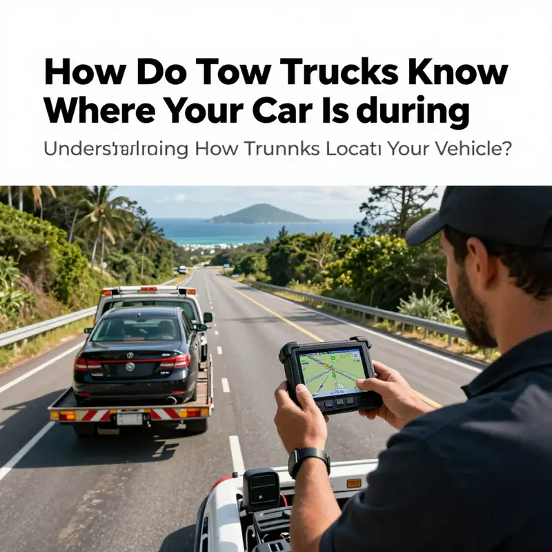
When a vehicle breaks down on a highway, the process of locating your car begins the moment you call for help. The dispatcher relies on a mix of data streams you authorize, devices you carry, and the service network’s capabilities to translate your location into a route for the tow truck. Modern systems may automatically share your position from your vehicle if you consent, using built in telematics or connected car features that can push coordinates to the service center. If the car is connected to cellular networks, the current position or last known location may be transmitted in real time, reducing the time to arrival and giving the driver a live sense of the scene. When automatic data sharing is not available or practical, your location can come from your smartphone. Location services on the phone can stream coordinates to the dispatcher or the roadside app, providing a live map view that the driver can follow. You can also describe your location verbally or with landmarks, mile markers, cross streets, or exits, and the dispatcher will cross check that information against mapping data to pinpoint where you are. The ability to switch between automatic data sharing and manual description helps protect privacy while ensuring you can still be located if one channel falters. The dispatcher then translates the data into a dispatchable task, identifies the nearest available tow truck, and issues turn by turn routing instructions to reach your coordinates. The driver uses a combination of road network data, traffic conditions, the truck’s location, and the fastest feasible route to reach you, adjusting as needed if a road is closed or if the scene changes. If an exact GPS pin is available, the truck can navigate to that point with little delay; if the location is less precise, the dispatcher may guide the vehicle to a general area and rely on your confirmation or additional landmarks to zone in. In practice, your preparation matters. Keeping telematics enabled, ensuring your phone is powered and its location services are on, and having a clear description of nearby cross streets or landmarks can shorten response times. You should also be mindful of privacy and consent, choosing the level of data sharing that feels appropriate for you in each situation. The goal is a cooperative effort where technology and human guidance work together to bring the tow to your exact spot as quickly and safely as possible. For further reading on how fleets plan and optimize emergency response and how drivers use location data to improve safety and response times, organizations like the national highway safety agencies provide guidance and case studies that illuminate best practices.
Crowd Clues on the Map: How Crowd-Sourced Alerts Shape Tow Trucks’ Awareness of Your Car
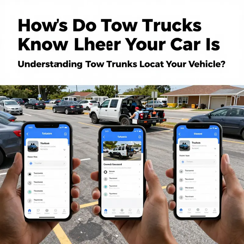
When people ask how a tow truck finds a specific car, the simplest answer is often the most correct: there is no single magical beacon. Tow trucks locate vehicles through a mix of official records, dispatch data, and, in some cases, crowd-sourced alerts from drivers themselves. Each path plays a different role in the broader system of roadside assistance, enforcement, and prevention. The chapter you’re reading peels back the surface layer of this network to reveal how crowd-sourced alerts fit into a much larger framework. It’s a story about maps, data, and the quiet ethics of sharing information in real time. It’s also a story about how being aware of these tools can help you make smarter decisions about where you park, how you react when a breakdown occurs, and what you do if your car is actually towed. In short, the landscape of locating a vehicle is a blend of formal procedures and user-generated signals, each piece doing its part to reduce confusion and wasted time when a car disappears from a curb or a lot. The central premise is simple but powerful: crowd-sourced alerts don’t tell a tow operator where your exact car sits. They illuminate patterns—where cars are commonly towed, where towing activity clusters, and when certain zones become hot spots—so drivers can avoid those areas and, ideally, avoid becoming part of the problem in the first place. This distinction matters because it sets expectations for what these apps can do and what they cannot. To understand the role of crowd-sourced alerts, it helps to see how tow operators and authorities locate vehicles in tangible, real-world contexts. The process begins, as many readers already suspect, with official records. When a car is towed after a parking violation, an abandonment notice, or an accident, law enforcement agencies or municipal towing services maintain records that are linked to the car’s license plate, the vehicle identification number, and the location where the tow occurred. These records are not mere paperwork; they’re the entry points into a chain of custody that allows a vehicle to be tracked as it moves from the scene to a lot, and eventually to the owner. The moment a plate number is registered as towed, the vehicle becomes a point in a data network accessible to the municipal systems, the towing yard, and, crucially, the owner whose notification is triggered by the incident. This is where the process begins for most tows that happen in city streets, on municipal routes, or at regulated parking facilities. It’s not a guess; it’s a documented action, anchored in the law and governed by administrative procedures that ensure accountability. There is a second path that often comes into play, especially in roadside emergencies. When a driver calls for help because a car breaks down, the tow company becomes the intermediary, bridging the distance between the stranded vehicle and the service needed. Here, the operator relies on modern dispatch tools that can collate location information from several sources. If the driver has shared location data through a navigation app on their phone, the dispatch system can translate that geolocation into a precise pickup point for the tow truck. If the vehicle itself is equipped with telematics or connected services—think of systems that report a breakdown or a fault along with location data—the tow operator can receive the car’s location directly from the vehicle’s own data stream. In both scenarios, the role of the driver’s consent and the customer’s explicit sharing of location data is central. It’s not a passive feed; it’s a shared stream that arises from a request for assistance. This is the realm where crowd-sourced alerts begin to intersect with professional operations, not as a substitute for official location data, but as a supplementary layer that enhances situational awareness and preparedness. Crowd-sourced alert apps operate on a different logic. They don’t broadcast a car’s exact whereabouts to every tow operator in the city. Instead, they invite drivers to contribute observations about towing activity, and they aggregate those reports into a map that shows patterns rather than pinpointing a single car. When you open one of these apps, you encounter real-time or near-real-time updates about ongoing towing incidents, zones with frequent tow activity, and tips about areas to avoid. These are the so-called “towing hot zones.” The value of such information is not in telling a tow operator precisely where your car sits. It’s in giving drivers a heads-up about risk, enabling better decision-making, and helping people minimize the chances of finding their own license plate in the tow yard later. The crowd-sourced model thrives on participation. It depends on users to notice and report, to share the location and timing of tow events, and to do so in a way that is accurate and timely. The system does not rely on a central oracle that continuously tracks every vehicle. Instead, it depends on the collective input of people who are moving through the same urban or island landscape and who have a stake in reducing unnecessary tows. This distinction is essential when you consider privacy and control. Users decide when to share, what to share, and with whom. The data that appears on the map is a curated mosaic of crowd input, sometimes tempered by the app’s own filters, but never meant to be a direct feed into a tow operator’s real-time tracking of an individual car. The practical effect is that, while the app can show a general sense of risk in a neighborhood or street, it does not replace the dispatch systems that locate actual vehicles. Instead, it complements them by informing drivers, who are themselves part of the ecosystem that creates and circulates data about towing activity. There is a psychological and behavioral dimension to this dynamic as well. When people see a map marked with hustle and bustle around a certain block, they are more likely to reconsider where they park, even if they are not towed at that moment. The map becomes a behavioral cue, a nonverbal sign that a place might be a higher-risk zone. This is not a violation of privacy but a form of public accountability that arises from the simple act of sharing an observation. The information architecture behind crowd-sourced alerts is designed for speed and accessibility rather than precision. Users report a sighting—“tow truck in action,” “a car being towed,” or “hot zone near so-and-so block”—and the app translates that into a visible marker on a map for nearby drivers. Sometimes the markers are continuous and dynamic, pulsing as new reports come in; other times they reflect clusters of activity, showing where members of the community have repeatedly observed tow operations over a certain period. The result is a living map of towing activity, a collective memory of the streets in which the community has a stake. Yet the map is not a surveillance feed. It does not show your car’s exact location to tow operators or to other drivers who might use the app. The design choice is deliberate. It preserves a degree of anonymity and avoids turning every driver into a data point in a private search. What it does provide is context: a sense of how often and where towing occurs, how quickly drivers respond to warnings, and how long it takes for a lane or a region to clear after an incident. The user experience centers on prevention. The moment you tap into the app, you enter a space where information is shared for the sake of avoiding missteps and misparking rather than spying on individuals. This distinction is worth reiterating because it speaks to the ethical boundaries of crowd-sourced technology. The app relies on voluntary input and consent. It requires geolocation sharing within the app’s environment, which means users opt in to contribute their location data for a given report. This is not the same as a passive, opaque tracking mechanism that follows a car everywhere it goes. The data never claims to be a precise, real-time pin on your vehicle; instead, it offers a probabilistic portrait of where towing is happening, which blocks are being watched by tow teams, and which times of day see the most activity. In practice, this means the app can help a driver make smarter choices about where to park, how long to linger in a curbside zone, and when to circle back to the vehicle to move it before a tow occurs. It can also serve as a warning system for people who are trying to recover a vehicle after it has been towed, because the collective reports can suggest when a tow yard is busy or when a particular lot has a backlog of towed cars. It’s a crowd-informed map rather than a crowd-tracking system. The limit to this approach, of course, is the same limit that any crowdsourced tool faces: accuracy depends on participation. If few people report, the map will be sparse and potentially misleading. If reports are delayed or misreported, the map can show a stale or erroneous snapshot. The design mitigates these issues with user incentives and moderation—things like upvoting accurate reports, validating reports with timestamps and location checks, and calibrating the map so that it remains useful even when data are imperfect. It’s a testament to how digital tools can transform ordinary days on the street into collaborative, shared intelligence that reduces friction and wasted time. But it also reinforces a practical truth: crowd-sourced alerts are supplements, not substitutes, for official location data. Tow operators still rely on dispatch work orders, license plate and VIN checks, and location data derived from the caller or the vehicle’s own connected systems when available. The crowd-sourced layer adds situational awareness for the public and the fleet alike, not a private beacon that broadcasts a car’s precise position to every actor in the system. This distinction matters in daily life. If you park in a zone known for heavy enforcement, the app’s map can be a prudent guide to avoid that risk. If your car is actually towed, you’ll use official channels to locate it, and the app may help you understand the broader pattern of activity in the area and whether the tow is part of a larger cycle in that neighborhood. For operators and fleet managers, the existence of crowd-sourced alerts invites a broader discussion about how to coordinate readiness and response. The same principles that guide emergency response planning in a busy urban environment apply here: the aim is to reduce uncertainty, improve response times, and minimize harm. In island or coastal settings, where roads and lots can be constrained by weather, tides, or seasonal traffic, crowd-sourced alerts can become a practical, real-time barometer of where to focus attention, where to allocate personnel, and how to adjust routes to avoid unnecessary delays. This is where a cross-pertilization occurs between public-facing apps and professional operations. Fleet managers and roadside assistance teams can learn from the crowd’s lived experience—where to expect heavy towing, which blocks tend to get targeted during certain hours, and how the community responds when a tow occurs. Yet the overlap ends there. The fleet’s need for precise, trackable, auditable data is distinct from the public’s need for awareness and prevention. The two systems can coexist with minimal friction, each serving different goals while reinforcing the other. The practical upshot for drivers is straightforward. If you want to leverage these crowd-sourced alerts as a preventative tool, treat them as one more piece of situational awareness rather than a guarantee. Read the map’s signals, but also observe signage and local rules. If you’re in a known enforcement zone, factor in posted limits and typical tow windows. If your vehicle is in a roadside emergency, use your phone’s location sharing judiciously to help responders find you quickly, while also taking steps to protect your privacy by turning off sharing once the incident is resolved. If you’re a fleet operator, integrate these alerts with your emergency response framework to reduce the time between a tow event and a confirmed recovery or a safe reroute for your drivers. The aim is to harmonize crowd-sourced signals with official processes so that citizens experience fewer surprises and a more transparent system overall. The internal link to industry strategies underscores this idea. In fleet contexts, the conversation about towing and emergency response often revolves around standardized protocols, training, and coordination across departments and partners. A well-constructed plan emphasizes clear lines of communication, redundancy, and ethical data practices. It also highlights how real-time awareness benefits safety, environmental considerations, and cost management—outcomes that resonate with both drivers and operators alike. From this vantage point, crowd-sourced alerts become part of a broader ecosystem rather than a standalone feature. They act as a public-facing mirror of how cities and service networks function in concert when a vehicle disappears from a curb or a lot. They remind us that the road network is not simply a string of meters on a map; it’s a dynamic system shaped by people, decisions, and shared information. As with any tool that relies on human input, there will be gaps and imperfections. But the strength of crowd-sourced alerts lies in their immediacy and their communal nature. The more people contribute, the richer the map becomes, and the more capable motorists are of navigating a landscape where towing is a predictable risk rather than an unexpected disruption. For readers who want to delve deeper into how fleets prepare for emergencies and how to design better, more resilient response plans, consider exploring related material on emergency preparedness for island fleets and essential fleet emergency response strategies. These resources expand the conversation from individual-driver decisions to organizational readiness, illustrating how a community-facing tool can complement structured protocols rather than replace them. In the end, the question of how tow trucks know where your car is is best answered as a tapestry of mechanisms. Official records identify and document when a car is towed. Dispatch data and vehicle telematics provide the precise coordinates required to recover a vehicle in a timely fashion. Crowd-sourced alerts map the rhythms of towing activity, offering a public, participatory layer that informs decisions and helps prevent unnecessary tows. The blend of these elements reflects a modern, data-informed approach to roadside services—one that respects privacy, relies on consent, and prioritizes practical outcomes over sensational immediacy. If you want to explore more about how these tools fit into real-world operations, you can explore the internal resource linked above, which frames emergency response as a coordinated, fleet-wide effort rather than a collection of isolated incidents. And for a broader look at how crowd-sourced information and official data intersect in the world of towing, see the external resource that details the functional side of crowd-based alerts and how they are used in practice by drivers who want to stay ahead of enforcement. External resource: https://apps.apple.com/app/towtrackwhiz/id1507824932
Final thoughts
Understanding how tow trucks find vehicles is essential, especially in island environments where resources and communication can be different from mainland operations. By being aware of the protocols in place—whether from towing incidents, emergency assistance, or crowd-sourced applications—local auto repair shops, dealerships, property managers, resort operators, and fleet owners can better navigate the complexities of vehicle recovery. Collaborating effectively with towing services not only aids in prompt vehicle recovery but also fosters a sense of community and support among locals.